Product Showcase
FRM In Action
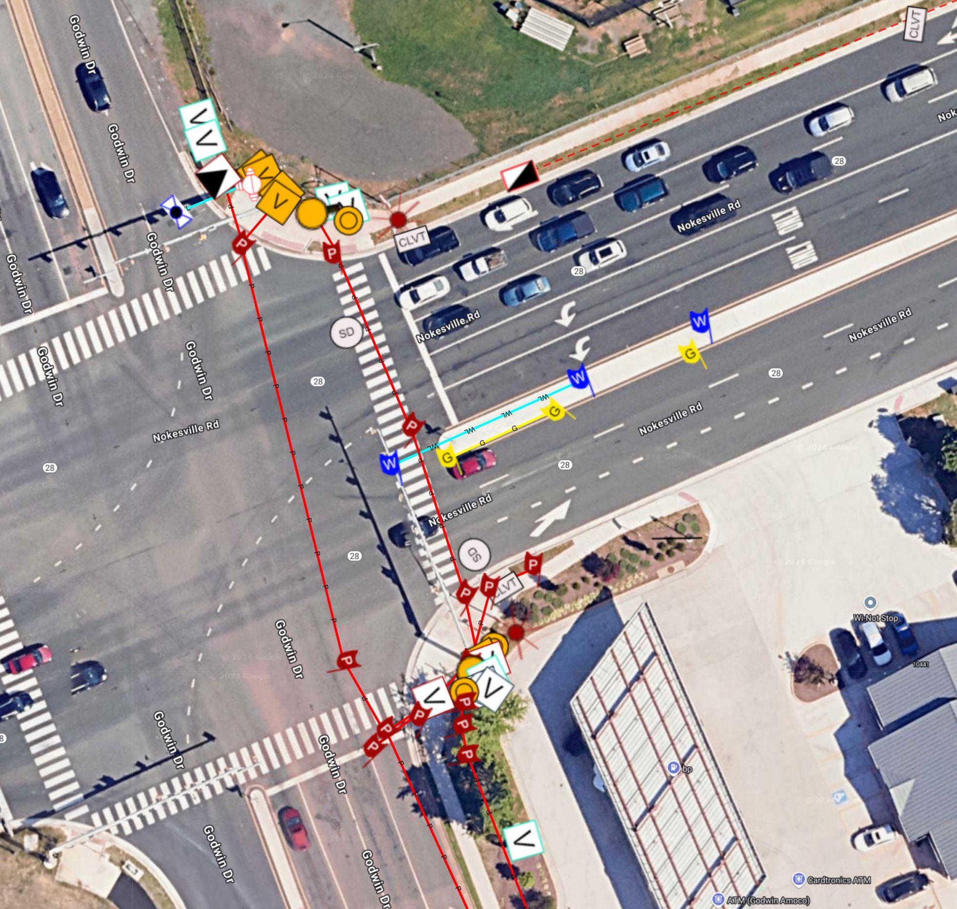
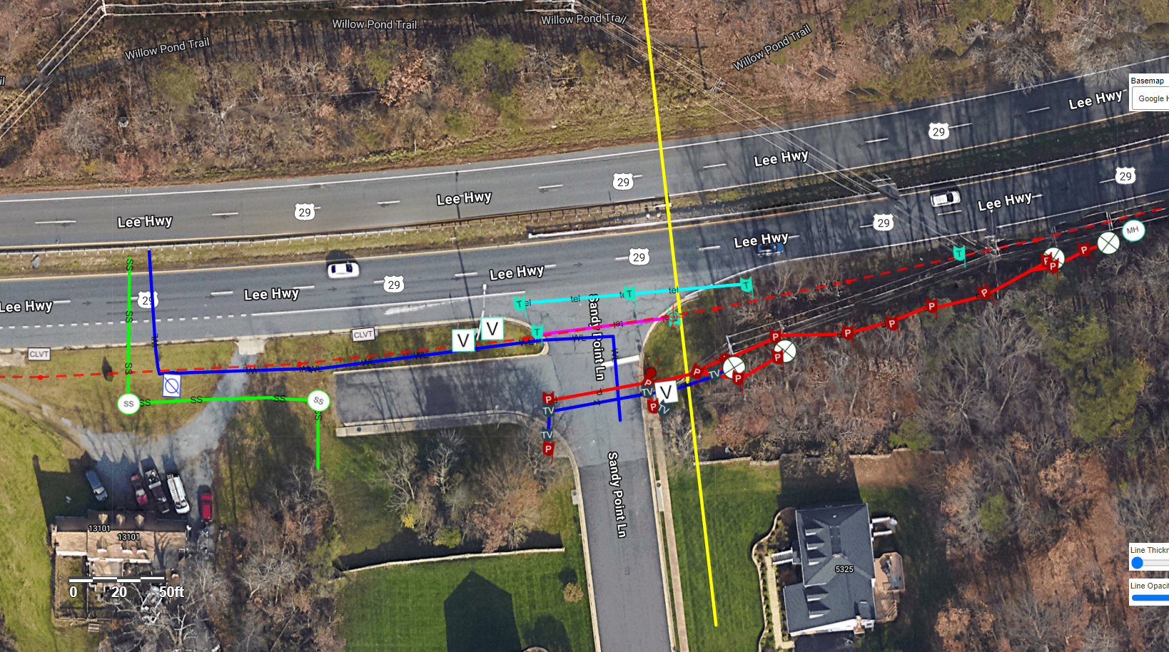
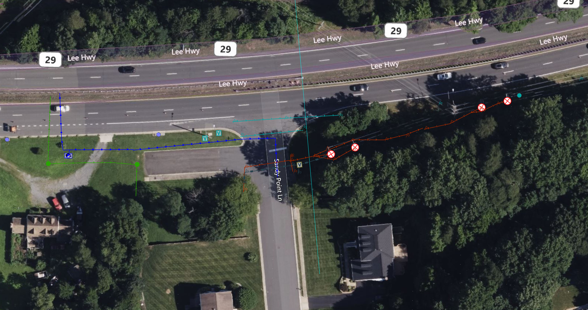
Live Utility Mapping
Utilities and surface features overlaid on satellite imagery
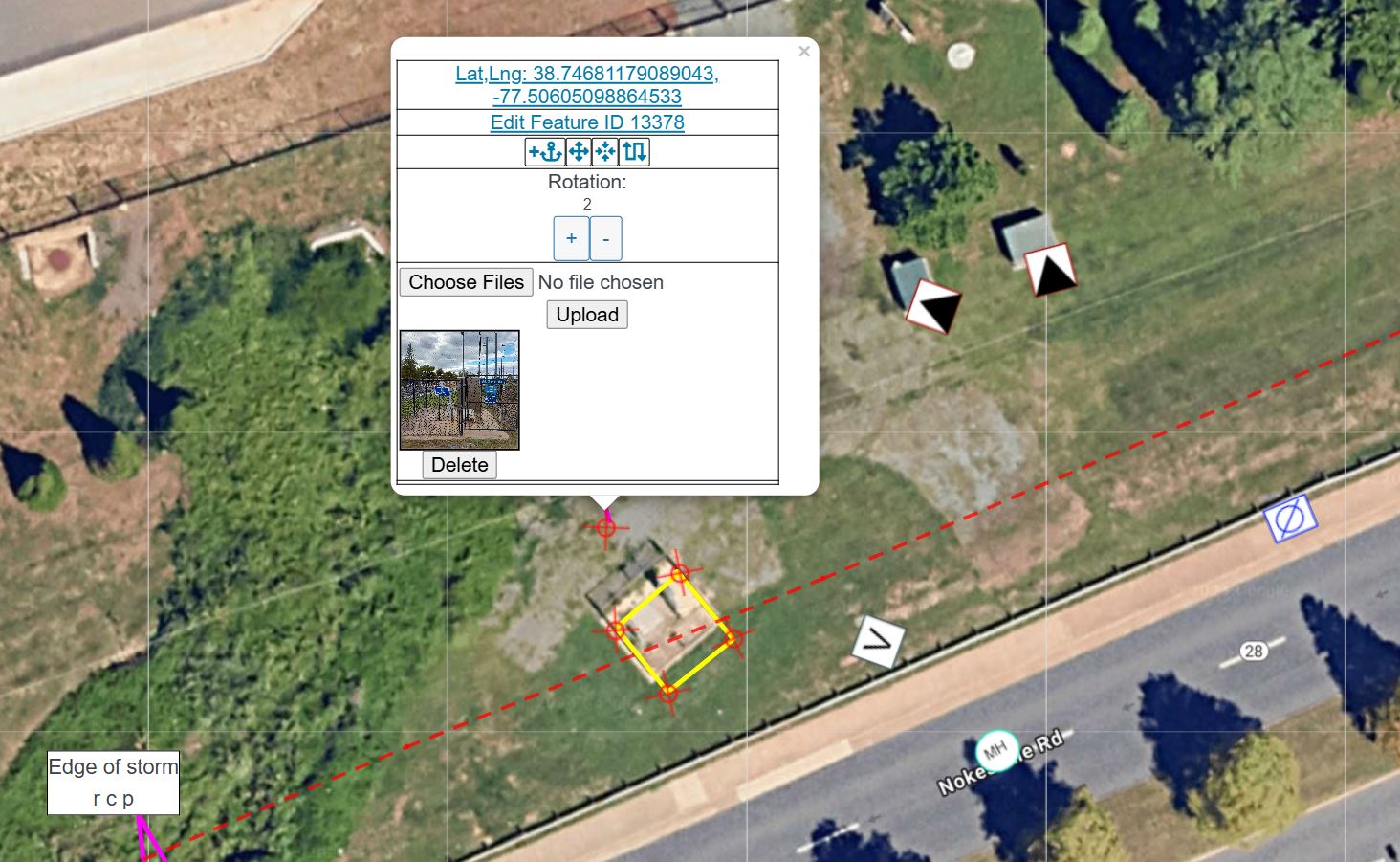
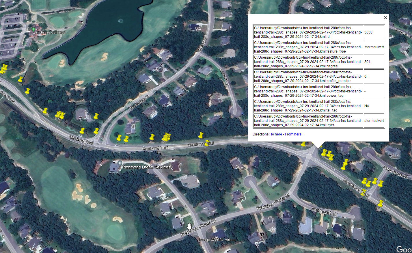
Feature Details & Photos
Capture coordinates, metadata, and attach photos to any feature
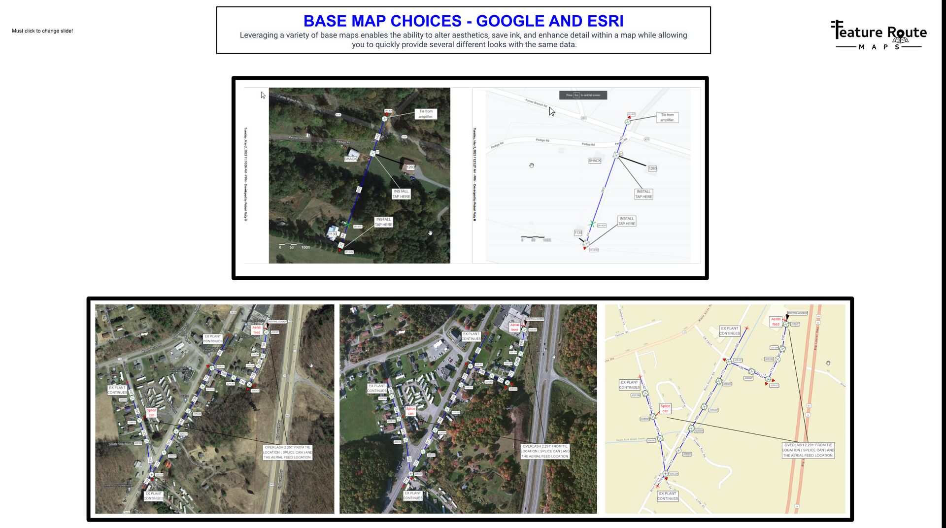
Flexible Base Maps
Choose satellite, street, or vector maps from multiple providers
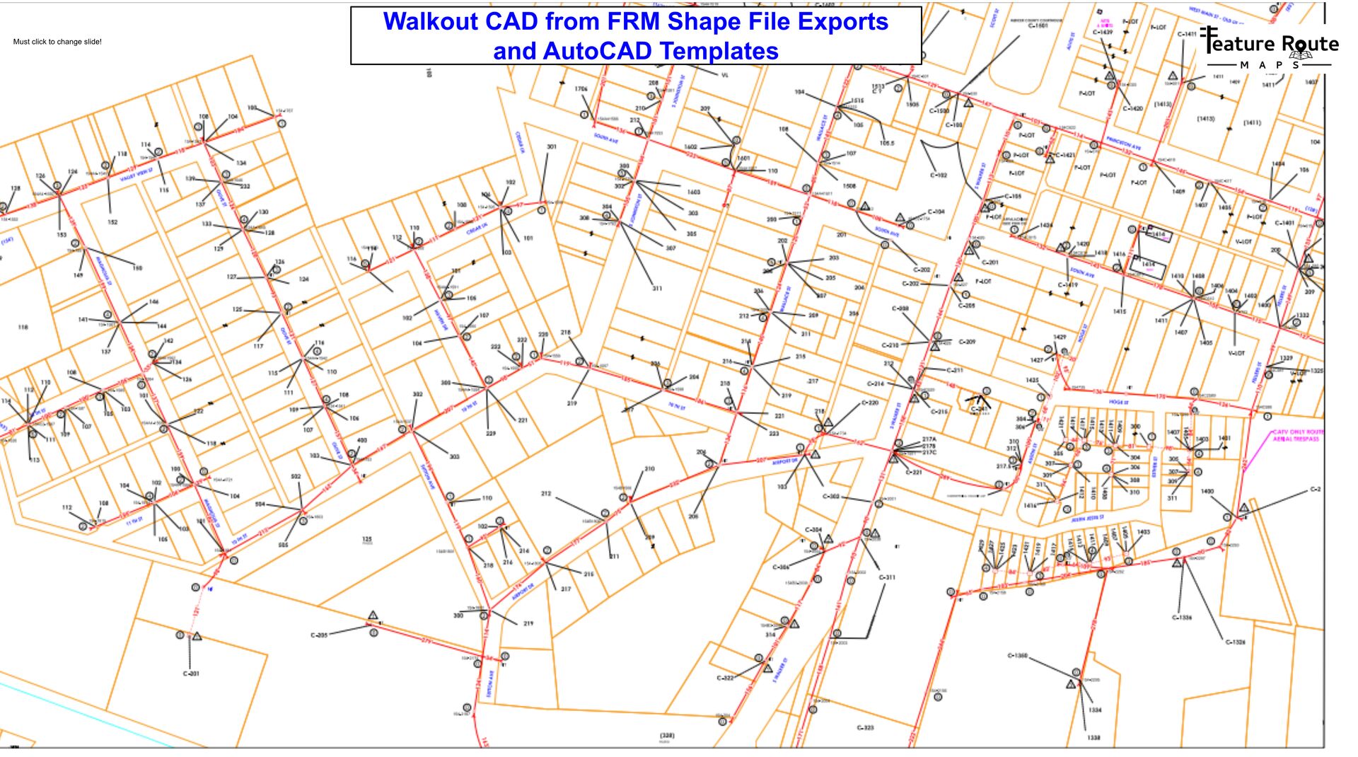
CAD-Ready Exports
Export color-coded utility layers directly to AutoCAD
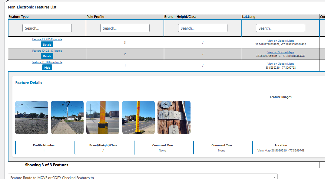
Project Management
Manage features, photos, and metadata in organized dashboards
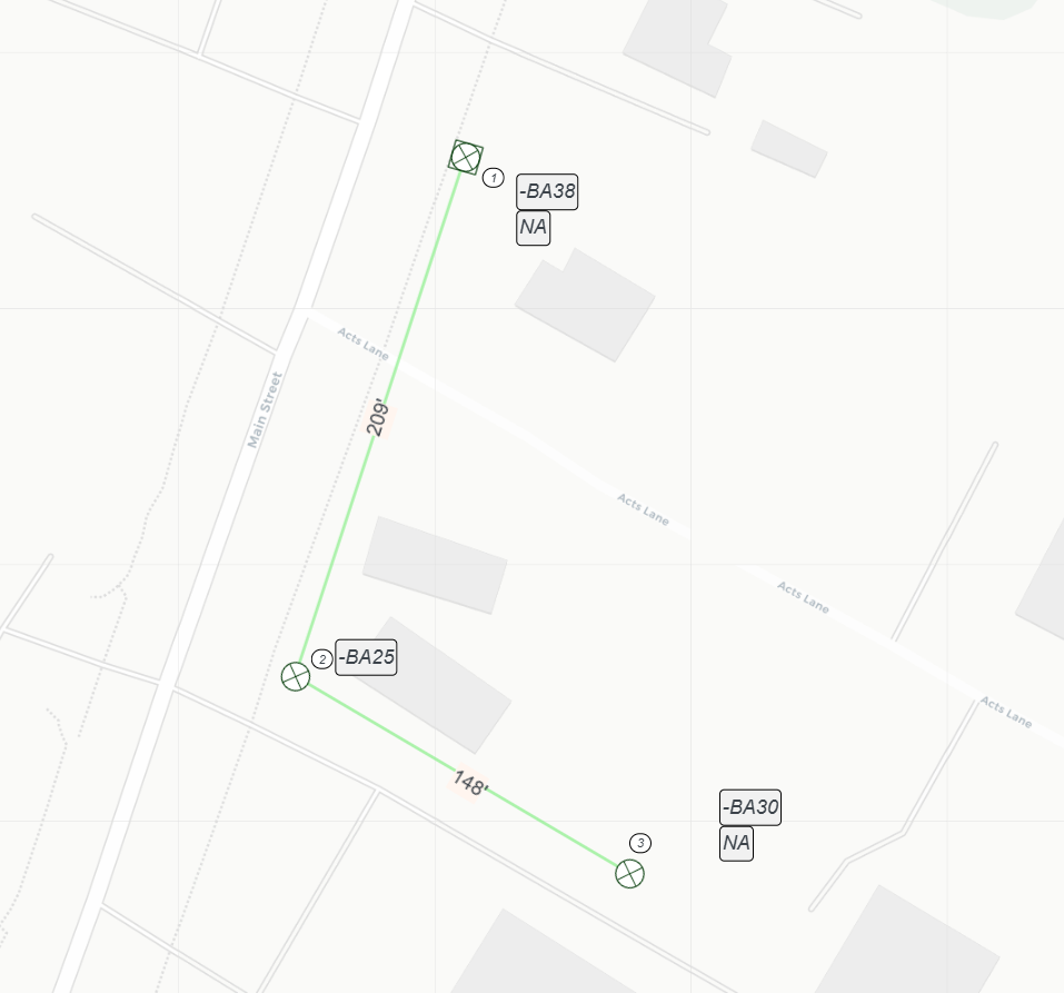
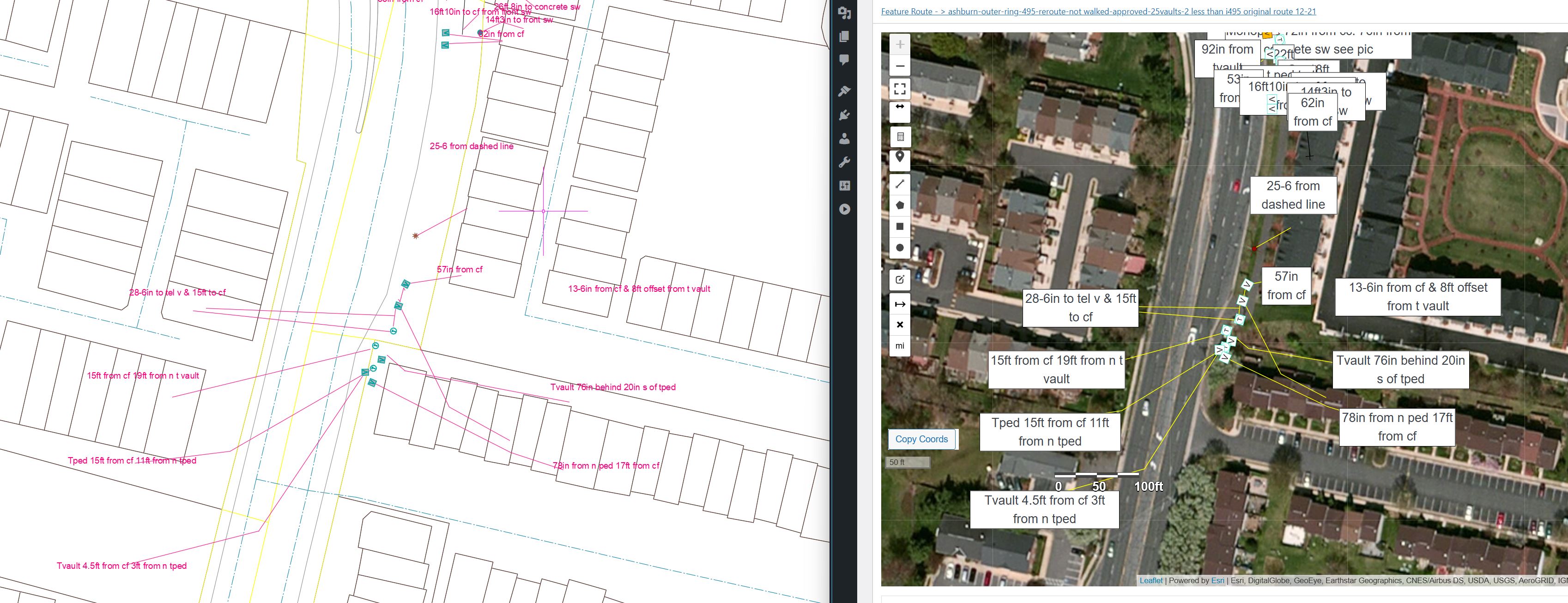
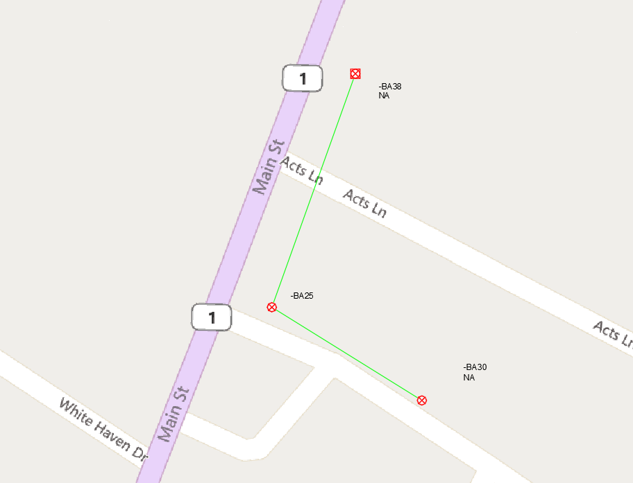
Detailed Route Views
Map poles and utilities along roads with precise placement